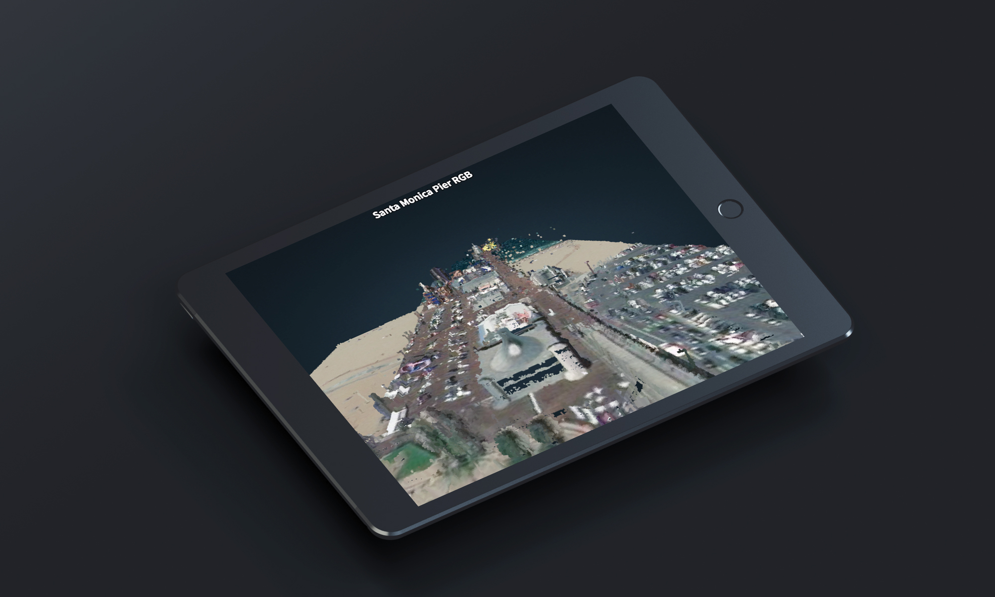
Online 3D point cloud viewer for Geo1 & Aerial Filmworks, converting LiDAR aerial scans into browser-navigable WebGL scenes.
Command-line tools, JavaScript, jQuery, POTree (WebGL), PHP, MySQL, WordPress
Geo1 (Aerial Filmworks, sister company)
Geo1 first engaged with TMS through wpDataTables, building a bespoke data application using TMS's own WordPress table plugin. The 3D point cloud viewer was a subsequent independent engagement that grew out of that relationship.
We worked with Geo1 on several projects, the most interesting so far being an online 3D viewer for point clouds scanned with special airborne equipment. Aerial Filmworks, a sister company to Geo1, operates the aircraft and scanning hardware used to capture the .LAZ LiDAR files that the viewer processes.
The system has two modules. An offline module converts the data files to a format readable by the viewer using PotreeConverter command-line tools. The online module provides the tool for uploading the scenes, embedding them into website pages, and configuring the layout in a WYSIWYG manner.
A focused 3-week engagement with rapid delivery.
It was a "background" project, worked alongside other commitments. Development took approximately 30 hours of coding and several hours of QA for verification. The full system, including the offline converter, WordPress plugin, embedding workflow, and snapshot feature, was delivered within 3 weeks.
LiDAR file conversion and WebGL point cloud rendering in the browser.
The core challenge was converting proprietary LiDAR .LAZ aerial scan files into a web-embeddable format. We used PotreeConverter command-line tools to transform .LAZ files into a set of chunked files that the POTree WebGL library can stream and render as interactive 3D point clouds directly in the browser.
The online module needed to accept the converted file sets and prepare embeddable blocks on the website. We built a WordPress plugin that lets administrators upload scenes and configure their layout in a WYSIWYG manner, without touching code or dealing with the underlying WebGL complexity.
The viewer had to work on all available devices, from desktop workstations to tablets and phones. WebGL point cloud rendering is resource-intensive, so ensuring smooth performance and navigation (zooming, panning, rotating) across hardware tiers required careful optimization of the POTree rendering pipeline.
The state of a 3D scene (camera angle, zoom level, visible layers) can be saved as a "snapshot," so the admin can choose the best viewpoint to present to end users. Implementing this required serializing the full POTree viewer state and restoring it reliably on page load.
A complete system delivered in 3 weeks, leading to ongoing engagement.
Full system delivered within the target timeline
Viewer works across desktop, tablet, and phone hardware tiers
Client engaged TMS for several subsequent custom development projects
We worked with TMS on several projects. First, we built a bespoke app based on their product, and then implemented additional independent custom solutions for our needs, including an online 3D viewer for point clouds filmed by our airborne equipment. Despite the time zone difference, TMS team was very responsive, always suggested several approaches for solving the challenges, quickly identified pros and cons of different solutions, which helped us deliver an optimal product.
Tell us about your product idea or your team's capacity gap. We'll outline the right approach for your situation.
Request a Free ConsultationCustom report generation tool with drag-and-drop layout builder.